ATTENTION: the excursion along Via Alta della Verzasca is recommended only for experienced hikers who have adequate equipment, and it requires a travel time of 4 or 5 days. It is therefore necessary to organize overnight stays along the route.
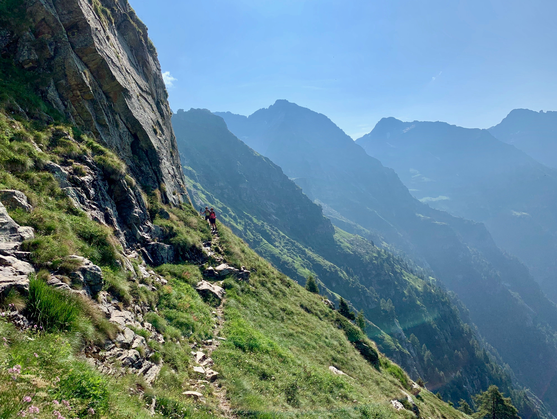
It is a challenging itinerary, with several stages, which connects five moutain huts offering splendid views of the most beautiful peaks of theTicino area.
PRE ROUTE: Vogorno- Rienza-Capanna Borgna
At Vogorno (492 m), start the walk on the paved road. Follow the signs towards Coletta on a path marked red and white. Reach Mount Rienza (1391 m) and continue to the Corte di Fondo of Alpe Mognora. From here you will notice a dirt track that leads to Capanna Borgna.
Stage 1 (difficulty T6)
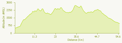
This is the longest uphill route in Via Alta along paths and ridges, walking on rock. It starts from Borgna hut (1912 meters above sea level) and continues towards Fümegna hut (1810 meters above sea level), Bocchetta Cazzane (2104 meters above sea level), Bocchetta di Leis (2215 meters above sea level), Poncione di Piotta (2439 meters above sea level), Poncione dei Laghetti (2445 meters above sea level), Poncione del Venn (2477meters above sea level) and Cornavosa (1991 meters above sea level).
Stage 2 (difficulty T5)
From Cornavosa, after spending the night, you continue on towards Efra hut (2039 above sea level).
Stage 3 (difficulty T5 / T6)
This stage goes from Efra hut to Cognóra (1938 above sea level), passing Pizzo Cramosino (2717 above sea level), Passo del Gatto (2612 above sea level), Madom Gröss (2741 above sea level) and Bocchetta di Cremisino (2549 above sea level).
Stage 4 (difficulty T4 or T6)
From Cognora over Passo Piatto (2105 above sea level) towards Barone hut (2172 above sea level) or with a variant of difficulty T6 from Pizzo dei Laghetti along the ridge, passing through Pizzo Campale and Bedea and continuing up to Cima dell'Uomo of Campionino
© Ascona-Locarno Turismo
Photo © SEV Società Escursionistica Verzaschese
More info on: https://www.ascona-locarno.com