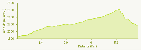
The proposed itinerary, which can be traveled from July to September (it is advisable to always check the state of the trail before departure), starts from the Swiss territory, and more precisely from Robièi (Ticino), to cross the Italian-Swiss border and reach the splendid Val Formazza where it will be possible to spend one night before departing again.
Robièi is known for the richness of its minerals and for its crystalline alpine lakes including Lake Robièi, an artificial alpine basin located at the foot of Basodino glacier and created by the homonymous dam.
It is a spectacular trek that leads us to the discovery of landscapes of indescribable beauty and on up to the top of the hill, crossing the Bocchetta di Val Maggia, in the Piedmont territory. Thus we arrive in Alta Val Formazza, first meeting the Boden lakes and then Castel and Toggia lakes.
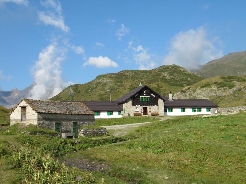
Once we have arrived at Alpe Toggia we get to the Maria Luisa Refuge to spend the night (booking recommended).
Info: www.outdooractive.com