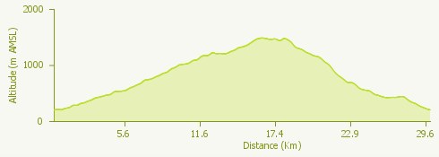
Cardada Bike 397 is a ring route, starting and ending in Locarno, which takes us on the discovery of the Cardada area and Val Resa, with fantastic views of the Swiss shore of Lake Maggiore.
The first part of the route goes uphill on an asphalted road until you reach Monte Brè, then a steeper stretch leads us through the village of Brè and then continues on along a flat stretch to then get back up to Alpe Cardada.
Crossing some challenging serpentines we arrive at Val Resa, we leave the woods and take the road that leads downhill, to get us back to our starting point, the town of Locarno.
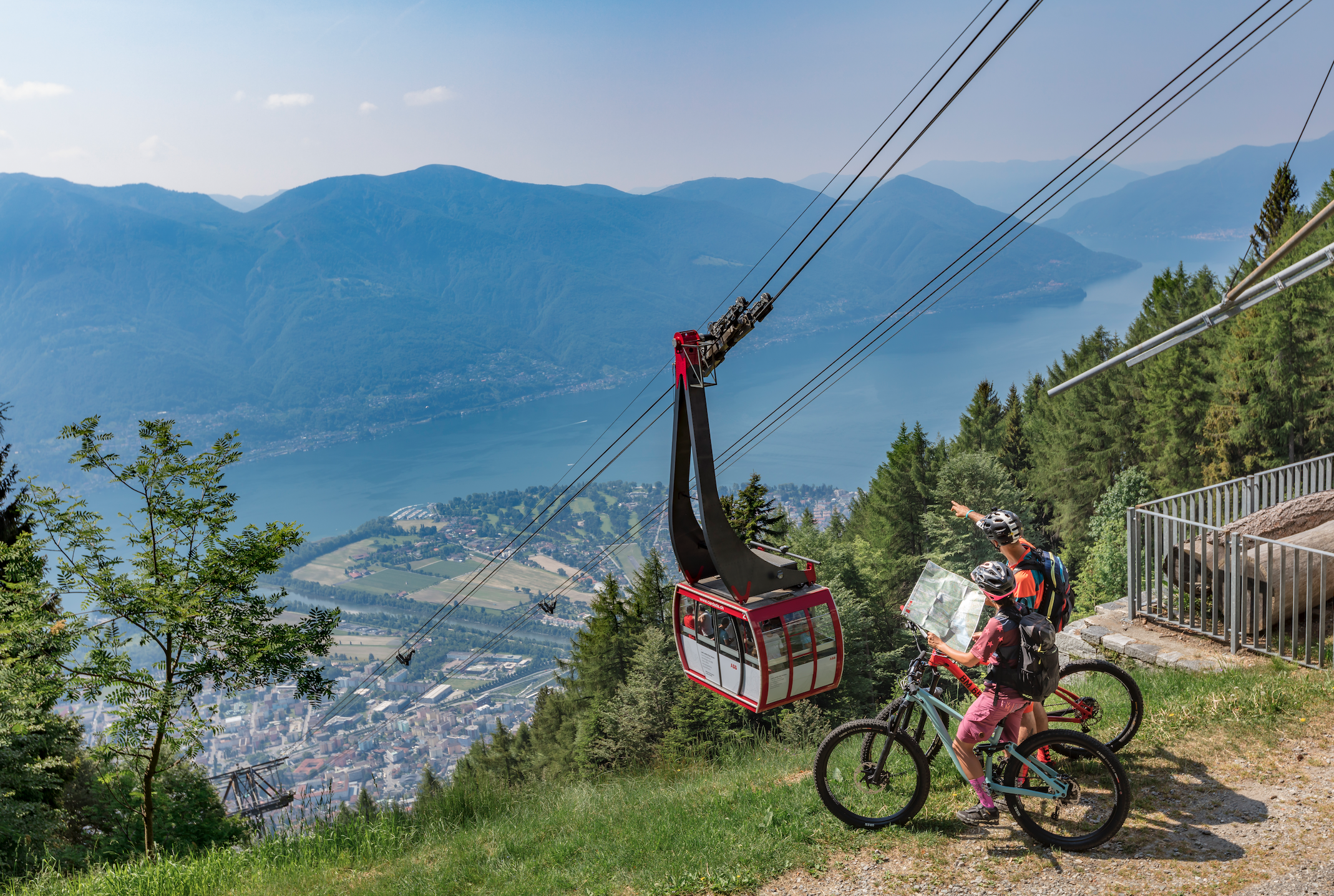
The route is an average one regarding technical aspects, but it is possible to use the Locarno-Orselina funicular and then the cable car in order to head out on only the segment towards Val Resa avoiding the uphill stretch.
© Photo Ascona-Locarno Tourism, Alessio Pizzicannella