How to get  
Select a route from the map {{directionsToLabel}}
{{currentWaypoint.label}}

Bettelmatt Trail

Riale (VB), Italy
Trail Running
Difficulties
Technique
Experience
Landscape
Length (Km) 57
Time 10
Average speed (km/h) 6
Starting altitude (m) 1730
Arrival altitude (m) 1730
Hightest point (m) 2900
Lowest point (m) 1420
Altitude difference (m) 3050
Period Summer
Waytypes Alpine hiking trail: 13,82 km
Hiking trail: 15,7 km
Path: 22,7 km
Country lane: < 100 m
Street: 103 m
Road: 1,13 km
Unknown: 3,77 km
Surfaces Alpine: 12,5 km
Natural: 4,74 km
Unpaved: 33,1 km
Paved: < 100 m
Asphalt: 1,16 km
Unknown: 5,65 km

Description

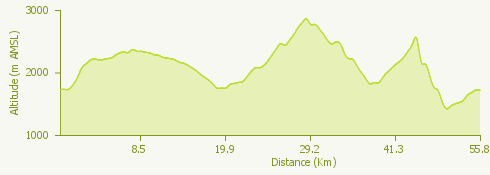
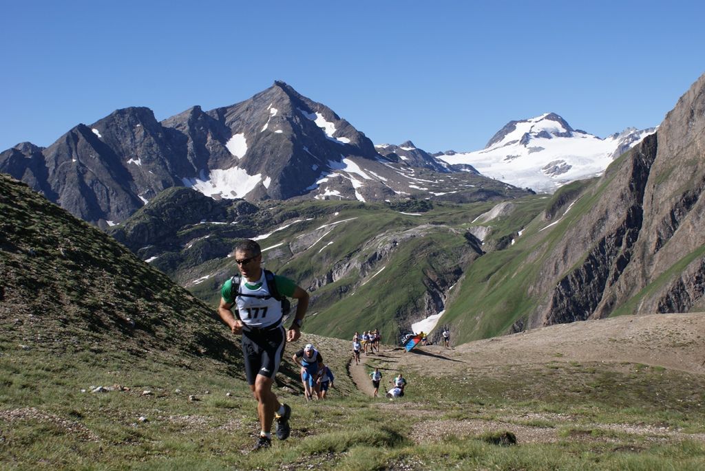
The Bettelmatt Trail is a route that extends for 52 km surrounded by the fascinating scenery of Val Formazza and it is part of the annual competition called BUT: a spectacular ride among the Lepontine Alps, between the high altitudes of Val Formazza and the wonders of Alpe Devero.

In addition to the Bettelmatt Trail, object of the GPX track attached to this route, the race includes three other different trails:

The 35km Bettelmatt Sky Race
The 22km Bettelmatt Race
The 8 km “La Stampa” Bettelmatt Mini Trail

For more information bettelmattultratrail.it

Surroundings

{{count}}/{{totalCount}} Upload More