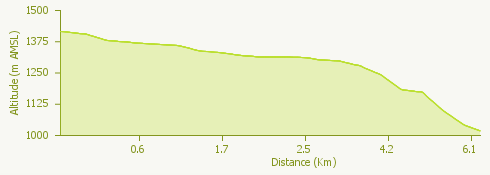
The "Ponte Campo" itinerary is characterized by a low level of difficulty and starts out from the center of San Domenico to go on up to Ponte Campo at the Gebbo dam.
Ponte Campo, located at the foot of the Alpe Veglia nature park, can be reached by taking the first stretch of paved road to then continue on along a dirt path.
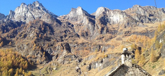
After going over the bridge that crosses the Cairasca stream, you can admire a landscape of pastures, huts, dairies and unspoiled and picturesque nature.
The route ends once you reach the dam, beyond which the stretch is not practicable and from which you can go back towards the bridge over the Cairasca.
Discover more trails on Sando Bike Park