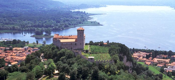
The route extends through the area of the province of Varese, from Lake Maggiore and the hamlet of Castiglione Olona to the Langobardian Archaeological Park of Castelseprio, a Unesco heritage site.
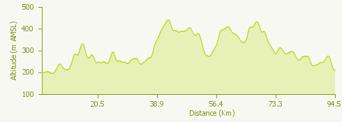
It is long, characterized by continuous ups and downs, but without any particular long and demanding climbs. Along the way, there are some fountains where you can quench your thirst.
Interesting and picturesque is the continuous change of landscapes and panoramas; in fact, there are 4 lakes that the itinerary runs along: Lake Maggiore, Lake Monate, Lake Comabbio, Lake Biandronno and the lake of Varese.
The route mainly extends along asphalted and secondary roads, but it passes through two inhabited centers where there is automobile traffic.