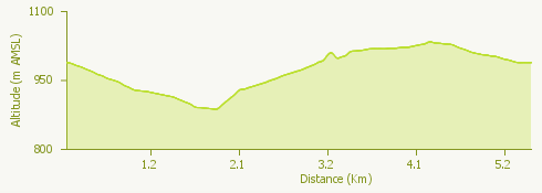
The itinerary is part of the routes proposed by the Trail Park of Mottarone and in particular it is route number 2, of medium difficulty.
All the alternatives and the material is available on the official website of the Mottarone Park: www.mottarone.it/trail-park
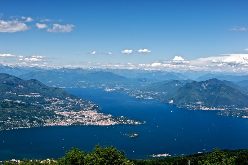
The natural park, which is visited all year round, is the ideal destination not only for those who love practising sport, but also for those who simply want to spend a day in the open air enjoying one of the most incomparable views of Lake Maggiore. From the top of Mottarone, in fact, it is possible to see Monte Rosa, the Po Valley and the seven lakes: Maggiore, d'Orta, Mergozzo, Varese, Comabbio, Monate and Biandronno.
©Credits: Parco del Mottarone Srl