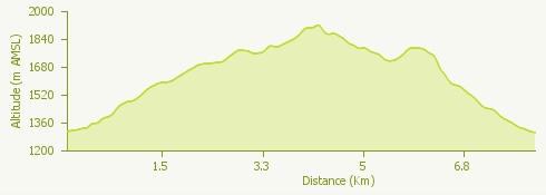
The proposed itinerary is an easy ring-route, which can be covered from spring to autumn and is suitable for everyone.
The starting point is the square in Staffa, from where the route continues as far as Pecetto to reach Bill via a mule track through the coniferous forest.
The Bill station can be reached in about an hour's walk. From the cable car station, the trail climbs briefly in the direction of the Monte Moro pass and then turns right to reach Alpe Meccia.
The return to Bill takes place along a stretch of woodland and then via the ski slope that descends from Moro.
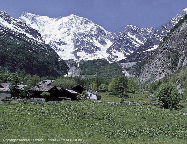
Alpe Meccia can also be reached from Staffa along the paved mule track.
© Comune di Macugnaga