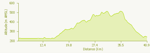
The itinerary begins in Stresa; from Piazzale Lido take Viale Lido and turn left to take the SS 33 in the direction of Arona.
We cover a flat stretch along the shores of Lake Maggiore and, after the towns of Belgirate, Lesa and Meina, we head towards Arona.
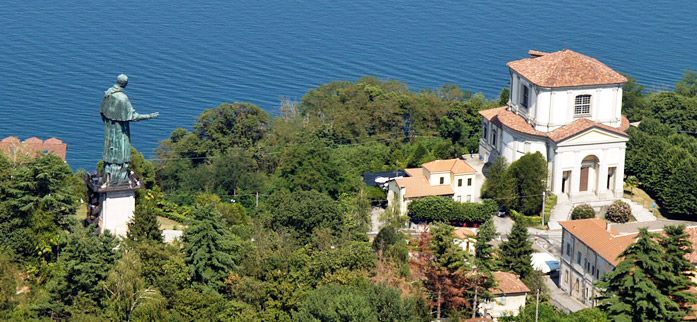
We follow the signs for Dagnente and the statue of San Carlo; the road climbs steeply enough to take us towards the colossus of the Saint. We continue, always uphill, and at the first fork we keep to the right. After reaching Dagnente we go down towards Ghevio, we pass the A26, and go up to via Ghevio-Dagnente and then via Meina.
Following the signs for Gignese, we pass Pisano and proceed up the hill that will take us to the village of Nebbiuno. We continue through the villages of Massino Visconti and Brovello Carpugnino.
Once past the entry of the A26 motorway, we turn right into via Gignese and descend towards Stresa. Once in Stresa, we continue towards the lake and we find ourselves at the entrance of Viale Lido up to the starting point of the itinerary.