How to get  
Select a route from the map {{directionsToLabel}}
{{currentWaypoint.label}}

From the cycle path of the lakes of Varese and Comabbio to Lake Maggiore

Angera (VA), Italy
Trekking Bike
Difficulties
Technique
Experience
Landscape
Length (Km) 60
Time 4 hours
Average speed (km/h) 15
Starting altitude (m) 190
Arrival altitude (m) 260
Hightest point (m) 280
Lowest point (m) 190
Altitude difference (m) 410 uphill, 330 downhill
Period All the year
Waytypes Singletrack: 4,10 km
Path: 268 m
Cycleway: 32,1 km
Street: 7,03 km
Road: 14,0 km
State Road: 116 m
Unknown: 3,15 km
Surfaces Unpaved: 4,79 km
Paved: 32,1 km
Asphalt: 20,2 km
Unknown: 3,69 km

Description

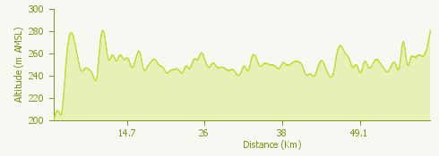
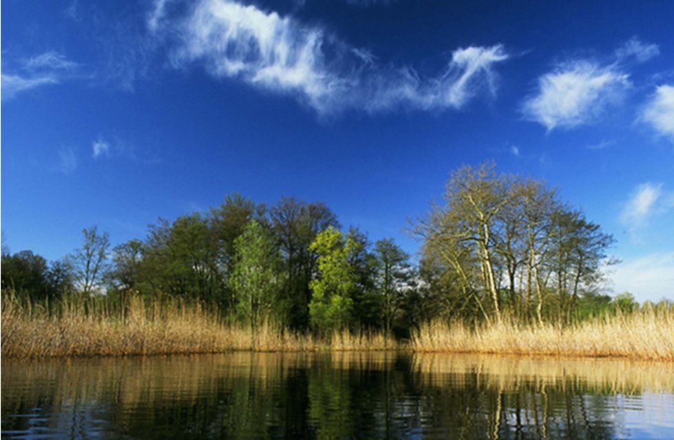
The itinerary starts from Angera and leads us towards the lakes of Comabbio and Varese along the cycle paths that run alongside them, through suggestive woods and reeds.

From Angera we move towards Taino along an asphalt road open to traffic.

In the village of Mercallo the cycle path that runs alongside Lake Comabbio begins; once in Varano Borghi we continue on the cycle path that runs alongside the Brabbia swamp and leads us to Lake Varese to continue along the cycle path that runs alongside the lake.

At the end of the circular route along Lake Varese we return to the cycle path along Lake Comabbio and finish the route at Mercallo.

Surroundings

{{count}}/{{totalCount}} Upload More