How to get  
Select a route from the map {{directionsToLabel}}
{{currentWaypoint.label}}

Anello Collina of Boca

Romagnano Sesia (NO), Italy
Trekking Bike
Difficulties
Undetermined
Technique
Undetermined
Experience
Undetermined
Landscape
Undetermined
Length (Km) 23
Time 1 hour 30 minutes
Average speed (km/h) 15
Starting altitude (m) 300
Arrival altitude (m) 300
Hightest point (m) 430
Lowest point (m) 300
Altitude difference (m) 190
Period March - November
Waytypes Singletrack: 246 m
Path: 7,39 km
Street: 3,78 km
Road: 10,7 km
Unknown: 1,02 km
Surfaces Natural: 1,25 km
Unpaved: 3,17 km
Paved: 8,46 km
Asphalt: 8,68 km
Unknown: 1,57 km

Description

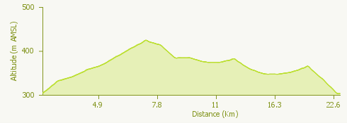
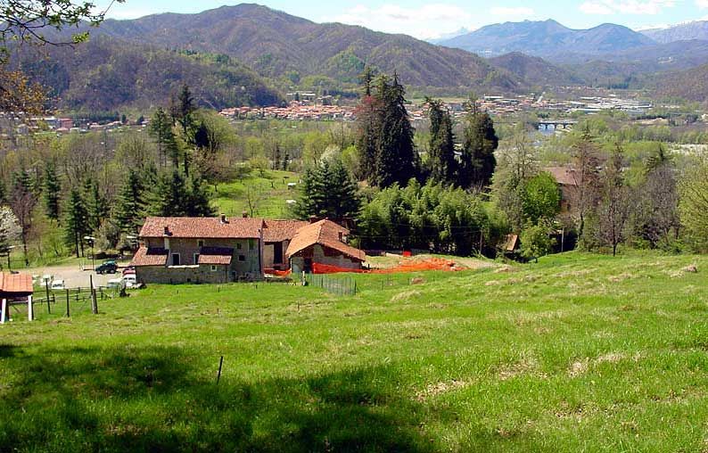
The itinerary starts from Romagnano Sesia, near Villa Caccia, and winds through the Novara hills, through the Monte Fenera Park, the Piano Rosa and the Baraggia and continues towards Prato Sesia, Cavallirio, Maggiora, Boca, Cureggio, Fontaneto d'Agogna, Cavaglio d'Agogna and Ghemme.

Characteristic of this route, which moves through woods, vineyards and hills, is the architectural richness of its landscapes that let us discover the wonders of Alessandro Antonelli, as well as - obviously - the many food and wine excellences of these hills and their naturalistic beauties.

Surroundings

{{count}}/{{totalCount}} Upload More