Departure point:
Baceno (VB), Italy
How to get there:
By train: Domodossola Station, Ferrovie dello Stato. Timetables: http://www.trenitalia.com/; www.ffs.ch
By bus: bus to Baceno, line Domodossola - Cascata del Toce. Timetables: www.vcoinbus.it
By car: A26 motorway to Gravellona Toce, then SS33 Simplon, after Domodossola, exit for Valle Formazza and after Crodo you will soon reach Baceno.
General Description:
The old Arbola Route is one of the 12 cultural itineraries of regional interest of Switzerland. You can go across this route in three stops and parts of this itinerary still follows today the old paved mule tracks. The “Antigorio Route” for Baceno and Devero, and the Arbola route were for many centuries the main trade route between Valais and Lombardy.
The route:
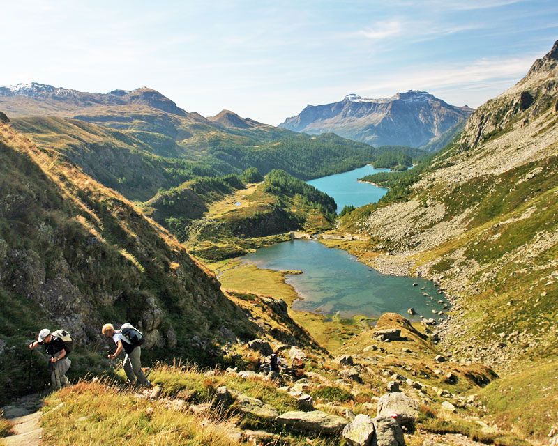
From Baceno’s sports field, you first reach Graglia, then Croveo, Osso, then a place called “al Passo”, Goglio and Alpe Devero. The itinerary passes (from Baceno to Croveo and from Goglio to Devero) through beautiful paved mule tracks and reaches some points of considerable interest: Baceno’s Church ( national monument), Croveo’s Parish Church, Croveo’s winepress, Croveo’s potholes, Agaro waterfall, and Devero plain. Next day, through a nice trail across the wood you can reach Crampiolo, lake Devero, then lake of Piamboglio and then you go up to the Arbola pass (Albrunpass), you will then go down on the swiss territory through Binntalhütte and cross the bogs of Blatt and Oxefeld to reach Freichi and, still through a trail, the beautiful walser villages of Fäld and Binn. From Binn, on the third day, it is possible to go on in less than 3 hours up to Ernen where you can reach Fiesch, Brigue and then Domosossola by public transport.
Useful informations:
From the centre of Ernen, it is possible to reach by bus Fiesch station. Then Brig by a regional train, and Domodossola by a cross-border train. For timetables www.ffs.ch
Where to eat:
Bar Trattoria Pizzeria Cistella (also room rental) – Frazione Croveo 28861 Baceno, VB, (IT) tel +39 0324 62085
Binntalhütte, SAC Delémont, (CH), Tel. +41 (0) 27 971 47 97