Departure point:
Trontano (VB), Italy
How to get there:
By train: Domodossola Station, Ferrovie dello Stato. Horaires: http://www.trenitalia.com/; www.ffs.ch Trontano station, Vigezzina railway train. Timetables: http://www.vigezzina.com
By car : A26 motorway to Gravellona Toce, then SS33 Sempione, exit for Domodossola and go on the SS337 of Vigezzo valley up to Croppo di Trontano and then take for Trontano.
General description:
The old market route is a hiking trail connecting through the Vigezzo valley and the Centovalli, Domodossola to Locarno along mule tracks used in the old times to carry goods and products of the valley to the towns markets. These mule tracks were used by many emigrants of the valley and by pilgrims to go to the Re Sanctuary, the Santuario di Re. On the Swiss territory, the trail is part of the Locarnese National Park Project (www.parconazionale.ch). The itinerary can be made in 3 or 4 stops.
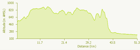
The itinerary:
From Trontano follow the signs for the watermills “Mulini del Graglia”, a group of 6 watermills recently renovated. Continue on the nice mule track up to Verigo, then along the forest path you will reach the characteristic village called Marone. Go down to the bridge Ca’ Turbin and then up to Mozzio and Coimo before continuing on the cycle and pedestrian trail until you reach Sasseglio, now entering the large high plateau of the Vigezzo Valley. You will cross Druogno and continue for Buttogno, Toceno, Vocogno and Craveggia, and go down then to Zornasco, up to Villette and finally you will reach Re.The second stage starts from Re and arrives to Dissimo and Olgia and reach the borderline in Ponte Ribellasca. From Camedo you will then enter in the Centovalli where the itinerary follows parts of nice mule tracks and small roads reaching Borgnone, Lionza (where there is the watermills park), Verdasio, Slögna, Costa, Pila, and then you reach Intragna where you can visit the Centovalli’s Ethnographic Museum and the bell tower, the highest of Ticino (65 m). On the third stage starting from Intragna you will go down to Golino and continue on the path along the riverbank following the river Melezza until its confluence with the river Maggia that you will follow up to the bridge of Losone, cross it and continue to follow the river Maggia until you reach the lake. From there through small roads you will reach the centre of Locarno and the station.
Useful informations:
Travelling by the Vigezzina train, it is possible to stop overnight in every village of the valley to then reach in the morning the departure point of the next stage of the itinerary.