Departure point:
Varzo (VB), Italy
How to get there:
By train: Domodossola Station, Ferrovie dello Stato. Timetables: http://www.trenitalia.com/; www.ffs.ch
By bus: bus for Varzo, line Domodossola – Iselle. Timetables: www.vcoinbus.it
By car: A26 motorway to Gravellona Toce, then SS33 Sempione, after Domodossola take the exit for Varzo and you will soon reach the railway’s station square
General Description:
The itinerary follows the village roads and the nice paved mule track “Veia di Bröcc” that from Ponte Boldrini to Bertonio goes up to Trasquera’s Church. Until 1961, when the road was built, this track was the only access to Trasquera. Some chapels adorn the itinerary that connects Varzo’s church to the one of Trasquera.
The route:
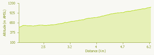
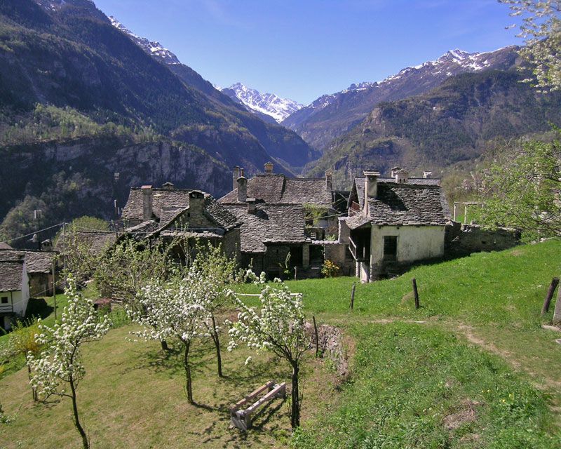
From Varzo’s railway station square take the road going up on the right, cross the old road and continue straight on following in direction of “centro” along Viale Castelli until you reach San Giorgio’s parish Church. In front of the tourist office cross the torrent and follow up through via Zanalda to the oratory of San Rocco in Alneda. Carry on via Alneda between stone houses until you cross the main road that goes up to San Domenico. On the left you will notice a nice building with a small tower: it is the office of the Ente di Gestione Aree Protette dell’Ossola, the agency of management of protected areas of Ossola. Take via Galtarossa continuing on the flat road and follow it until the end until you reach Bertonio. At the level of the Antica Osteria you will cross the old road of the Simplon. After a short stretch on the sidewalk, follow on the main road until reaching the Ponte Boldrini that crosses Cairasca torrent. The track starts where the bridge ends, on the right. You will go up through many turns, beech and chestnut trees (possible stops at the Cappella del Pianzolo and Cappella del Sasso chapels) until Trasquera’s parish Church, situated in a suggestive position on a rock sheer above the valley bottom. Continue on the main road via Alpi Lepontine until you reach the centre of the village. From Trasquera it is possible to go down to Iselle’s railway station along the itinerary called “Kirsch e Tulipani”.
Useful information:
From Trasquera a “percorso didattico”, an educational trail made of 12 information panels goes up to Fraccia: follow the wooden arrows.
Where to eat:
Agriturismo La Fraccia, Località Trasquera - Alpe Fraccia, VB, (IT) Tel.+39 320 14 89 213. http://www.fracciaagriturismo.it