Departure point:
Baceno (VB), Italy
How to get there:
By train: Domodossola Station, Ferrovie dello Stato. Timetables: http://www.trenitalia.com/; www.ffs.ch
By bus: Bus for Baceno, line Domodossola – Cascata del Toce. Timetables: www.vcoinbus.it
By car: A26 motorway to Gravellona Toce, then SS33 of Gravellona Toce – Sempione, exit Valle Antigorio Formazza, follow the road SS 659 of Valle Antigorio Formazza up to Baceno.
General Description:
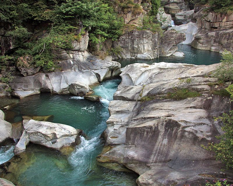
The stretch of Antigorio Valley between Premia, Baceno and Verampio, on a geological and morphological point of view, has been characterized by an impressive action of modeling from the glaciers and streams that left important and complex signs as rarely in the Alps can be observed. A series of informative panels helps in reading and understanding of geological and morphological changings.
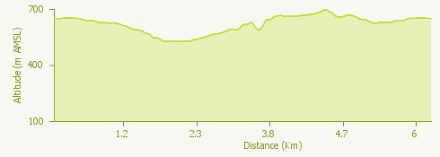
The route:
From the bus stop, crossing Baceno, you arrive at the Church of San Gaudenzio, National Historical Monument. Take the paved mule track to the side of the church, along the rock on which the church is built, full of large crystals of garnet. Follow the trail up to the plain of Verampio, reaching the arched bridge over the Devero river. Before the bridge turn left on the track. After about 800 meters, in Maiesso, the river Toce is crossed by a bridge that allows you to observe from above the Element Zero, the deepest tectonic element known of the Alps, and the spectacular circular erosive forms of the Giants potholes, due to the action of the swirling sub glacial streams. Without crossing the bridge continue on the path up to the entrance of the Southern Gorge: more than 200 meters long, and deep between 20 and 30 meters, equipped with metal stairs.
Once you passed the Southern Gorge the road continues up to the Oratory of Santa Lucia. The small Eastern Gorge opens itself near a stone hut. At the exit, on the left, a trail leads to Uriezzo. From here continue on the mule track up to the junction for the Western Gorge, going down until you take again for the trail in the wood. Along the trail you will see a big boulder dropped from the ancient glacier. After a short walk you will take again the track for Baceno.
Useful information:
For information and specialized educational visits for schools contact:
Geological Laboratory G.B. Castiglioni (Visitor Center Park veglia Devero, Crodo), www.areeprotetteossola.it (section The action of the Park, Environment Education) – tel + 39 0324 72572, mail info@areeprotetteossola.it
Where to eat:
Ristorante Pizzeria Campagna, Frazione Verampio, 1 - 28861 Baceno (VB), Tel: +39 0324 62349 campagna@vcomia.com
Agriturismo "Il Piccolo Ranch", Frazione Verampio - 28862 Crodo (VB), Tel. +39 380 8625678, il.piccolo.ranch@live.it