Departure point
The oratory in Cheggio.
How to get there
Cheggio is reached by car, climbing the Valle Antrona from the town of Villadossola. Cheggio may also be reached on foot from Antrona in an hour and 55 minutes.
Significant aspects of the route
The new Alta Valle Antrona Regional Park is an area characterised by the presence of pastures that are still cultivated, charming hamlets and an emerald lake, locked in by a narrow valley that only in its highest part, where the Rifugio Andolla is situated, opens onto the harsh peaks of the Pizzo Andolla group. Red deer, roe deer, marmots and ibex are the most easily spotted animals on the scree slopes and in the clearing where very varied alpine vegetation flourishes.
The route
From the piazza in front of the oratory in Cheggio, follow the road leading to the hard standing for the ropeway near the dam. Cross the wall of the dam to reach the first fork for Alpe Fraccia and the Passo della Forcola and then a second fork where you will find a spring (20 minutes).
After having crossed a wooden bridge, you will reach the characteristic crucifix and then proceed, crossing a second bridge, along the Loranco and climbing through to Alpe Gabi which offers a fine panorama.
After having left the lakeshore path on the left, you reach the chapel at Piana Ronchelli (50 minutes). You then continue to climb gently as far as the fork for Alpe Campalamana and then the alpe itself in an attractive valley. From this pasture, after having left on the left the path for the Pozzoli lakes with the Tibetan bridge to be crossed, you enter the so-called Cervi area, a kind of valley that open in correspondence with the Alpe Camasco (50 minutes).
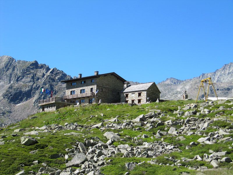
You will pass the small huts built where they are sheltered from avalanches and cross a stream before heading for the summit of Alpe Andolla and from there the refuge of the same name (40 minutes). The group of buildings that have been constructed in this place over the years lend it the appearance of a small oasis, rich in history.
The Rifugio Edison was built in 1923 and then renovated by the Villadossola section of the CAI in 1953. The new structure was inaugurated in 1986; in the meantime, the barn was erected and in 2011 the Rifugio Vecchio was restored and a chapel was dedicated to St. Bernard (patron saint of climbers and alpine dwellers). This is an ideal place for a rest or an overnight stay: in the evening you may watch the ibex that descend to graze on the pastures.
The return leg follows the path that heads from Piana Ronchelli to Alpe Gabbio and back to Cheggio (an hour and 40 minutes).
Useful information
Bus: from the international railway station in Domodossola a bus leaves for Antronapiana from where a shortly to be introduced bus service will reach Cheggio.
Food and drink: Albergo Ristorante Alpino (Tel. +39 0324 575975) – Rifugio Città di Novara (Tel: +39 0324 575977) – Rifugio Andolla (Tel. +39 0324 575980).