Starting point
From the lakefront of Omegna, on Lake Orta, close to the Town Hall.
How to get there
By car
Autostrada A26, exit at Gravellona Toce.
By train
Omegna railway station, on the Domodossola – Novara line
By bus
See the website VCO in bus
Main features of the route
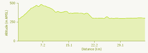
The path offers panoramic views of astounding beauty over the Orta lake and Cusio. This itinerary is not particularly trying and follows a ring shape over an asphalted road.
The route
The tour starts in the little town of Omegna, close to the Town Hall. Go along the western side of Lake Orta and climb to the fork “delle tre cascine” (three farmhouses). Turn left here across the bridge over the Fiumetta stream.
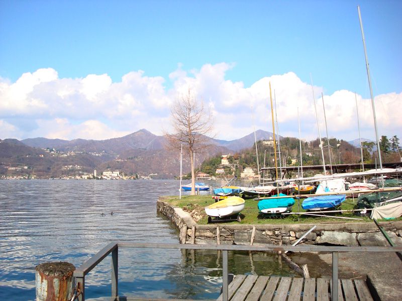
From here you have a good view of the rocky shore of the lake, sloping gently upwards to Brolo. On the left you have a panorama of the most romantic lake in Italy; to the right is the 18th century Villa Tarsis. The road continues on the level for a short distance, shaded by woods, as far as the village of Nonio.
After this you enter the valley of Monte Camosino and reach Cesara after around 1.5 km, where the road begins to go downhill. Look out for a drinking fountain by the side of the road inside a hairpin bend. The descent is initially hardly perceptible, along the banks of the river Pellino, but becomes steeper as far as the “Plin” bridge.
A short uphill stretch takes you to Vertraggia, form where there is a marvellous view of the lake. After less than 1 km you come to the village of Alzo. After the church you must pause in the shade of an ancient horse-chestnut to enjoy the panorama of the lake. A little farther on is a memorial to the stone-masons of the area (in dialect “picasass”), carved out of granite from local quarries.
Go straight on past the first roundabout; at the second roundabout turn left for San Maurizio d’Opaglio, the most important town in Italy for the manufacture of taps.
Once you have gone through the traffic lights, continue on the level to the village of Sazza. Don’t miss the frescoed façade of the little 14th century church of the Madonna di Luzzara on your left.
Continue on the level as far as the roundabout at the turnoff for Pogno, where you take the exit for Gozzano. Do not go into the town but take the turnoff towards the Regional Road (SR) 229.
The road descends to the shore and winds along the side of the lake to Miami and then Imolo. From here the route leaves the lake and continues for Pettenasco, arriving at the pretty village of Ronco. From here you can see your destination – Omegna, recognisable by the church tower; a 5 km ride takes you into the town.
Useful information
Buses run from Omegna to Gozzano.
Refreshment facilities
There are various places to eat and drink in Omegna, Brolo, Nonio, Cesara, Alzo, S. Maurizio d’Opaglio, Miami, Gozzano and Pettenasco.