Starting point
The itinerary starts from the village of Villa Lesa, a tranquil holiday resort lying at 225 mt a.s.l., where you can see the ruins of an ancient castle, the Castellaccio. The leafy village is in an out-of-the-way location at the foot of a small hill.
How to get there
By car
Autostrada A26 towards Gravellona Toce, exit Arona/Carpugnino/Baveno. Follow the SS 33 “del Sempione”.
Autostrada A8 (Milano – Laghi), exit Castelletto Ticino. Follow the SS 33.
By train
Lesa Station
By bus
Arona/Massino Visconti/Lesa, Arona/Novara/Domodossola and Novara/Arona/Verbania lines. Info: www.pirazzi.it, www.safduemila.com, www.stnnet.it
General features
The itinerary winds through an environment typical of this area, the Upper Vergante, with a rich presence of ancient villages, farmhouse and oratory churches. The route leads away from the lake shore and up into the foothills. The Erno stream, which enters Lake Maggiore at Lesa, runs here in a narrow bed, and the shores of the lake are characterised by a landscape composed of old villages, villas and historic gardens.
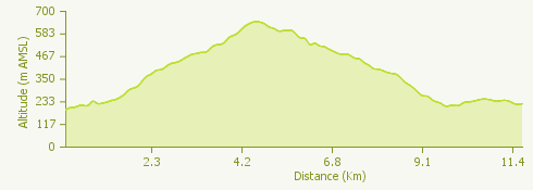
Description of the route
The itinerary starts from Villa Lesa, where you can see the ruins of the so-called “Castellaccio”. A surfaced road leads to the centre of Lesa, where there is the church of San Giorgio and San Giovanni Battista.
After going a short distance along Via alla Parrocchia, Via Belvedere and Via per Comnago, you follow a path winding though the woods, between drystone walls and terraces, a fascinating environment of striking visual impact.
The path continues to Carpugnino and then goes up to Comnago, from where there is a stunning view taking in the whole of the southern part of Lake Maggiore, from the Rocca of Angera to Arona.
When you get to the central square of the village, take the path that goes through a wood of deciduous trees to Monte alle Croci. Here the oratory church of Maria Ausiliatrice stands among majestic beeches at a strikingly beautiful viewpoint.
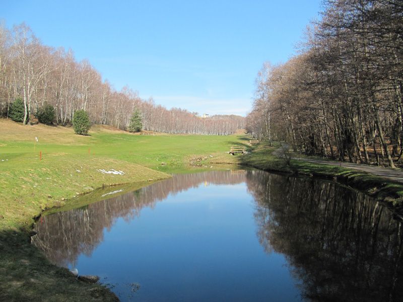
Leaving the hill, make a detour to the left to see the Oratory church of Santa Cristina, in a clearing with a picnic area and close to a golf course. Go back and continue the path uphill to reach the surfaced road where a short walk takes you to Calogna. From the church of San Bartolomeo go down on an easy path to the Oratory church of San Paolo. Continue from here to Belgirate.
A little above the village of Belgirate is the “old” church of Santa Maria. Go down in the direction of the railway station along a path that takes you back past villas and gardens to your starting point in Villa Lesa.
Useful information
Bus
Arona/Massino Visconti/Lesa, Arona/Novara/Domodossola and Novara/Arona/Verbania lines. Info: www.pirazzi.it, www.safduemila.com, www.stnnet.it