Starting point
Piazza del Municipio, Casaleggio Novara
How to get there
By car
Autostrada A4 Milan-Turin towards Vicolungo (exit Biandrate)
Provincial road (S.P.) 12 (San Pietro Mosezzo - Vicolungo), 14/A (Casaleggio Novara - Castellazzo Novarese) and 81 (Casaleggio Novara - Mandello Vitta).
By train
Casaleggio Station
By bus
Novara – Biandrate – Vercelli line. Timetable on www.fontaneto.it and www.stnnet.it
General features
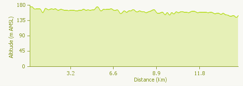
The route is over level terrain and takes you past ancient fortified villages and abbeys. It’s an easy walk which can be enjoyed at any time of year, on foot, by bike or on horseback, and doesn’t require any special training or equipment.
The walk is a combination of beautiful scenery and great historical and cultural interest. It’s perfect for enthusiastic walkers but also for the less energetic looking for a relaxing excursion amid unspoilt nature with the added attraction of the historic villages.
The route covers the second stage of the Sentiero Novara (Novara Way), which crosses the whole of the province for 200 km in 19 stages.
Description of the route
Starting from the Town Hall in Casaleggio Novara, a short walk takes you to the parish church of Sant’Ambrogio. The church is first mentioned in records as far back as 997; it has a single nave with eight side chapels, and has Baroque features. Worth seeing inside are frescoes and paintings which in the opinion of some experts are by Morazzone and his school. Going back towards the Town Hall, take the road leading to the ancient fortified place called Torre del Castello. Continue along the surfaced road for around 45 minutes to reach Vicolungo, with its 15th century castle and fortress and several churches of immense artistic and religious interest; outstanding is the church of Santa Maria delle Grazie.
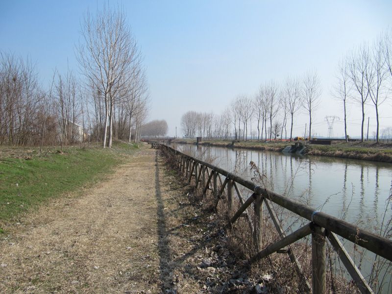
Continue through the green countryside along the path to the village of Recetto, crossing the Bolgona Canal. As you go into the village you will see the ancient oratory church of Santa Maria (11th cent.) and the remains of the walls that once surrounded the village. In the centre of the village is the Parish Church of San Domenico (14th cent.) and the recently restored Via Cascinali.
Go on along the surfaced road to the bridge over the Cavour Canal. A short detour on the cycle track takes you to the Oratory Church of Madonna delle Nevi (Virgin of the Snow) and a farmhouse converted into a guesthouse. The only dirt track in the itinerary starts here, taking you to the village of San Nazzaro Sesia.
The village’s main feature is the Benedictine Abbey of San Nazzario and San Celso, the most important abbey complex in the whole of the provinces of Novara and Vercelli. It was founded in 1040 by the Bishop of Novara, a member of the family of the Counts of Biandrate.
Useful information
Bus: from Novara. See the sites www.stnnet.it and www.fontaneto.it
Refreshment facilities: Osteria Tabarin (Vicolungo) tel. +39 0321 835190, Osteria Piaza Pita (Recetto), Osteria del Peggiore (San Nazzaro) tel. +39 0321 834214.