Departure point:
Piedimulera (VB), Italy
How to get there:
By train: Piedimulera Station, Ferrovie dello Stato. Timetables: http://www.trenitalia.com/; www.ffs.ch
By bus: bus for Piedimulera, line Domodossola – Pieve Vergonte, Domodossola – Macugnaga and circular line Domodossola – Beura - Villadossola. Timetables: www.vcoinbus.it
By car: A26 motorway to Gravellona Toce, then SS33 Sempione, exit for Piedimulera and you will soon reach the centre of the village.
From Saas Almagel (CH): bus to Visp and train to Domodossola. Timetables: www.ffs.ch
General Description:
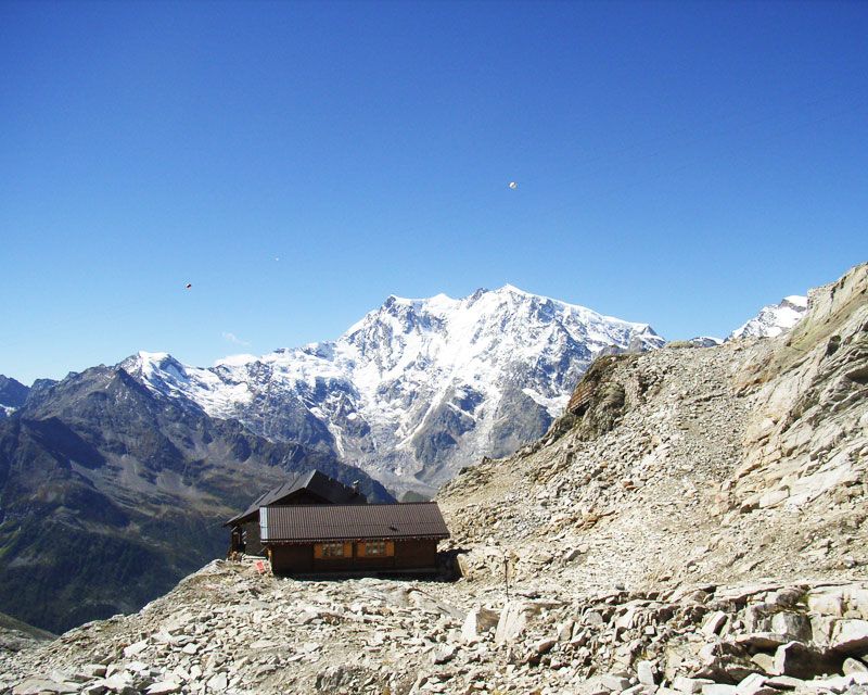
4 days itinerary along the old mule track of the Anzasca Valley (Stra’ Granda), the first description dates back to 1553 by the Spanish Governor in Milan. There are many testimonies of rural life along the old route that crosses this valley which is divided between two cultures, Walser and Romansh. In Macugnaga the impressive East face of Monte Rosa offers a unique scenary in the Italian Alps.
The route:
From the Torre Ferrari of Piedimulera you reach Cimamulera by a short but steep climb passing through the village of Croppala. From here you will continue for most on a flat trail up to Meggiana and Meggianella and after Castiglione’s church you will arrive to Pecciola. Continue towards Molini (nearby is the beautiful church the Chiesa della Madonna della Gurva), the village of Duiamen, then Antrogna, Calasca Dentro, Barzona and from here in 20 minutes you reach Pontegrande (you can stop overnight in Bannio Anzino). On the second day you pass by the village Case Pucci and soon you will reach San Carlo, you will pass in front of Battiggio’s beautiful medieval tower and arrive in Vanzone. You will pass by Valleggio, Croppo, Canfinello, Borgone and Ceppo Morelli. Here you walk along the lower part of the village up to the stone bridge crossing the Anza river and you go up to Prequartera. Then on a road up to Campigli, you will leave it to take the path that leads to Morghen and continue on a large mule track until you cross the river Anza on the bridge Ponte del Vaud and go on up to the ruins of the old mine of Pestarena. From here you go up to the plain of Fornalei, you reach Iselle and then Macugnaga-Staffa and the old Walser village close to the Chiesa Vecchia continuing towards Pecetto. On the third day you go up from Macugnaga Staffa to the Moro Pass. Finally on the fourth day from the Moro Pass you go down to Switzerland up to Saas Almagel.
Useful information:
Trail B0 to Macugnaga; then TMR - GTA from Macugnaga to Saas Almagel. From Macugnaga-Staffa to the Moro Pass it is possible to use the cable railway Macugnaga-Alpe Bill and Alpe Bill-Monte Moro so that you will make the itinerary shorter of one day.
Battiggio’s Medieval Tower: http://innovatorre.it/.
Borca, museums and mines: http://www.museowalser.it/ http://www.minieradoro.it/Untitled-1.html
Where to eat:
Ristorante Pizzeria del Tiglio, Località Gurva 28873 Calasca-Castiglione VB, (IT) tel +39 0324 81122
Ristorante Pizzeria Concordia, Via Monte Rosa, 11 28879 Vanzone San Carlo VB, (IT) Telefono: +39 0324 828967 www.ristorantepizzeriaconcordia.it
Ristorante Mondo d'Oro, Via Trabucati, 9 – 28875 Ceppo Morelli VB, (IT) Tel: 0324 890118 www.hotelmondodoro.com