Departure point:
Varzo (VB), Italy
How to get there:
By train: Iselle Station, Ferrovie dello Stato. Timetables: http://www.trenitalia.com/; www.ffs.ch
By bus: bus for Varzo, line Domodossola – Iselle. Timetables: www.vcoinbus.it
By car: A26 motorway to Gravellona Toce, then SS33 Sempione, after Domodossola take the exit for Varzo and you will soon reach the square of the station.
General Description:
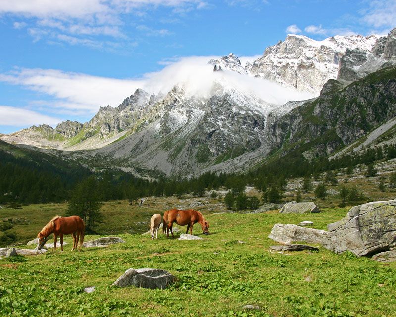
The trail takes you to high pastures, lakes and alpine passes crossing the main pastures. The whole itinerary allows the visitor to appreciate characteristic environment of pastures of Ossola and Switzerland, coming into contact with those living and working in the place, and giving you the possibility to observe animals, pastures and activities carried out.
The route:
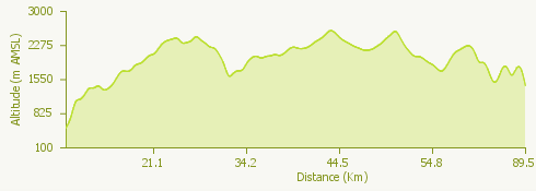
The itinerary connects Alpe Veglia with the Gotthard cheese factory, theCaseificio del Gottardo, reaching Alpe Devero (where you can visit the Pasture’s Museum, Museo dell’Alpeggio), the large plateaux of the Formazza Valley, the San Giacomo Pass (important old trading road with Switzerland) and on the Swiss side, one part of the road of the Alps, the “Strada degli Alpi” in Bedretto Valley. The itinerary can be walked in 6 days divided into the following stages:
1. On mule tracks and large areas from Varzo to Alpe Veglia;
2. On a nice trail crossing Alpe Veglia - Alpe Devero;
3. Alpe Devero - Rifugio Margaroli;
4. Rif. Margaroli - Riale di Formazza;
5. Riale - Ronco in Bedretto Valley (in Ronco the tour engages on the road of the Alps “Strada degli Alpi della Val Bedretto”);
6. Ronco - Airolo, main centre of Leventina Valley, at the foot of the pass and Gotthard Tunnel, important railway junction between North and South of the Alps. The arrival point of the itinerary is the Gotthard cheese factory in Airolo with its exhibition area, outlet and restaurant.
Useful information: Caseificio del Gottardo in Airolo www.cdga.ch. From Pesciun to Airolo you can avoid a 600 meters’ difference in height by using the cableway (Impianti di risalita San Gottardo SA, Tel: +41 91 873 30 40 www.airolo.ch). From Airolo you can return by train passing by Bellinzona or Andermatt and Brig (CH). Timetables: www.ffs.ch