Departure point:
Villadossola (VB), Italy
How to get there:
By train: Villadossola Station, Ferrovie dello Stato. Timetables: http://www.trenitalia.com/; www.ffs.ch
By bus: bus for Villadossola, Circular South line, line Domodossola - Pievevergonte and line Domodossola - Antrona. Timetables: www.vcoinbus.it
By car: A26 motorway to Gravellona Toce, then SS33 Sempione, exit for Villadossola.
General Description:
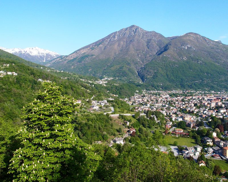
Hillside hiking trail going from Villadossola to the Sacro Monte Calvario (UNESCO World Heritage) and continuing up to Bognanco on historical stone roads. A blast from the past that allows you to understand the landscape of old agrarian economies in the mountain around the plain of Ossola.
The route:
From the railway station take the central corso Italia until you cross the stone bridge on the Ovesca Torrent. From piazza IV Novembre follow for via Croppo and then via Pioda. A flight of stairs leads to Cà dei Conti, where you follow on a trail towards Boschetto hamlet, and then along the aqueduct up to the megalithic site of Varchignoli. Follow on the right (trail “Via torchi e dei mulini”). Pass by the hamlet of Sogno. Shortly after you will cross the Rio dell'Inferno and continue going up and down up to Alpe Maianco inferiore, and through vineyards up to Tappia. Continue through chestnuts trees towards the chapel of gold, the Cappella dell’Oro where there is a viewpoint. The passage of the Rio dei Mulini precedes the arrival to Anzuno, with the Oratory of Saint Anthony of Padua, a balcony on the Toce Valley. Go down by the nice mule track until Crosiggia among the vineyards of “prunent”, the typical vine of Ossola. You then reach the Sacred Mount Calvario (UNESCO World Heritage) with a short asphalted trail going up. Descent to Domodossola along the shaded route of Via Crucis.
Useful information:
Sacri Monti of Piedmont and Lombardy, Unesco World Heritage list: www.sacrimonti.net; http://whc.unesco.org/en/list/1068
Riserva del Sacro Monte Calvario di Domodossola: www.sacromontedomodossola.it
Where to eat:
Agriturismo della Tensa, Località Tensa, 28845 Domodossola, VB, (IT), +39 340 6088716 +39 0324 346031, http://www.agriturismotensa.it
Circolo Acli Santa Croce, Borgata Sacro Monte Calvario, 28845 Domodossola, VB, (IT) Tel. +39 0324 47049