Departure point:
Masera (VB), Italy
How to get there:
By train: Domodossola Station, Ferrovie dello Stato. Timetables: http://www.trenitalia.com/; www.ffs.ch Masera sation – Vigezzina railway.Timetables: www.vigezzina.com
By bus: bus for Masera, North Circular Line Domodossola - Masera - Crevoladossola: www.vcoinbus.it
By car: A26 motorway to Gravellona Toce, then SS33 Sempione, exit for Val Vigezzo - Masera .
General Description:
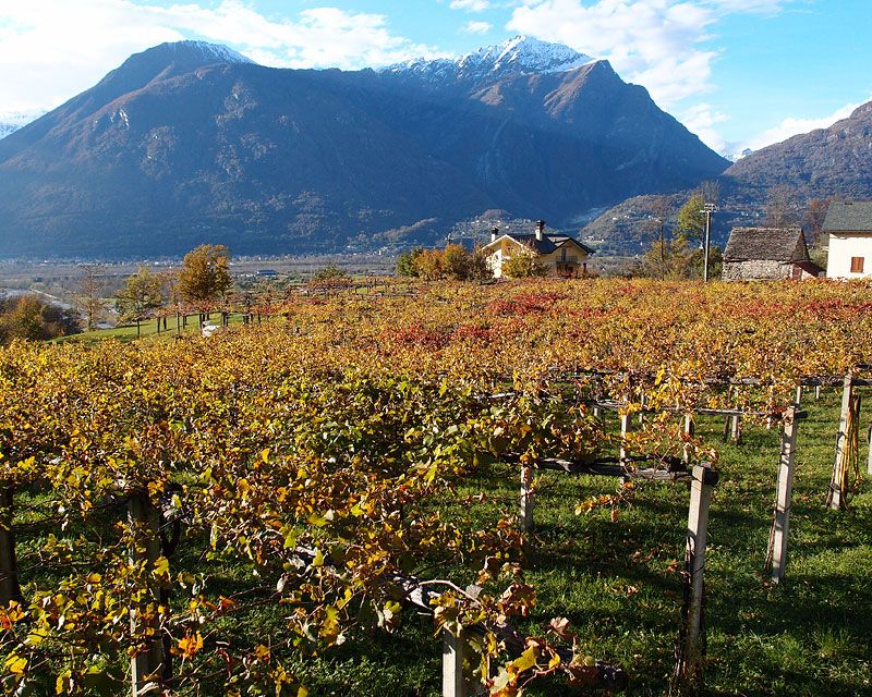
An impressive panoramic view of the plain of Ossola and Trontano, between ancient villas and terraces where is grown the famous grapes of Masera. Circular itinerary to do throughout the year.
The route:
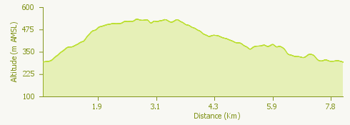
From the Vigezzina railway station, once passed the bridge on the torrent Melezzo, you reach the parish church of San Martino. Take for Via Carale, pass under the stone arcade and go along the stone building of the “old prison” (railings on the windows). After a short stretch on the mule track, cross the road and you will meet a trail that goes along the rio Fasciol and on the right, after the bridge, the oratory of S. Elisabetta. Continuing up you will arrive at the village of Quartavolo. Carrying on you reach the oratory of Sant’Antonio and from here is the start of a nice trail in the chestnuts and oaks wood passing through the ruins of Case Ariola (nice fresco of the Madonna del Sangue) and through Loraccio. Once crossed the road you go down to Ranco Sopra and then Ranco Sotto. Take the trail that cuts the road curves and once you passed the small chapel you will reach Case Brencio. Walking along the wall of a villa you go down to Rivoira: a short deviation on the left along the road, you will have the possibility to see a beautiful house with tower and to reach the park of Villa Caselli, that is absolutely worth a visit. Back to the square in Rivoira you go up to Case Bariino to then reach Rogna and Cresta (oratory of S. Bernardo). From here you go along the track that leads to Menogno di sotto, then on the small square you go up to Menogno di sopra where following a flat track above the road, you will be back on the road. Always following the red marks inviting on short deviations you will go back in front of the church.
Useful information:
Itinerary of the town of Masera indicated as red trail (Percorso Rosso). http://www.comune.masera.vb.it/
The famous Masera’s grapes celebration is held each September (“Festa dell’Uva di Masera”): http://www.festadelluvamasera.it/
Where to eat:
Osteria del Divin Porcello, Frazione Cresta n.11 28855 MASERA (VB) Tel. +39 0324.35035 - Cell. +39 348.2202612, www.divinporcello.it/
Agriturismo Moon Light Ranch, Via P. Ferraris n.5 28855 MASERA (VB) Tel: +39 0324 232879, http://www.agriturismomoonlight.it/
Trattoria Vigezzina, Via Statale n.337 28855 MASERA (VB), Tel. +39 0324.232874