Departure point:
Cuzzego (VB), Italy
How to get there:
By train: Domodossola Station, Ferrovie dello Stato. Timetables: http://www.trenitalia.com/; www.ffs.ch
By bus: bus for Cuzzego, South Circular Line : www.vcoinbus.it
By car: A26 motorway to Gravellona Toce, then SS33 Sempione, exit for Villadossola, cross the Toce river, turn right and go along the DOMO2 until you reach Cuzzego
General Description:
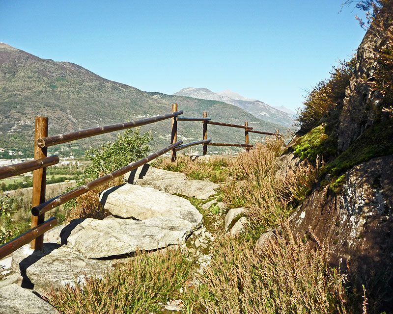
A Latin inscription from 196 A.D., carved in the rock near Vogogna attests the existence of a Roman road along the Ossola Valley. Between Cuzzego and Beura’s station it is possible to walk a long stretch of the road surprisingly well preserved.
The route:
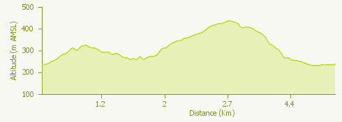
From the bus stop of Cuzzego follow the road towards North (Beura), cross the bridge and pass the junction for Villadossola up to a road sign indicating the start of the trail entering on the right and on its first part goes along the torrent until it reaches a building. Here a plate remembers the start of the Roman road. The old mule track goes up to a group of mountain huts then deviates on the left. From here the trail is more evident and passing on big stone slabs continue almost always on a flat trail until you pass an old abandoned quarry. Still continue on the flat and go along the row of rockfall protection nets, you will cross the road going up to Cardezza. Following the road signs go up along the old mule track cutting the curves reaching the square of the church of Cardezza. With a very short deviation along the via delle Cappelle you can go up to the oratory of Sant’Antonio. Back on the square of the church you will follow the road up to the cemetery where a sign indicates the trail going down, the “strada del pane” (road of the bread), path along which was once brought the bread to Cardezza (where there was no oven). Once reached the chapel “At Sant Isepp ai Scupei” the track continues up to the locality of “Cà Pinauda”, then starts to go down to the chapel of “Scarp”, to then carry on until the square of the church of Cuzzego and then to the bus stop.
Where to eat:
Trattoria delle Alpi, Piazza della Chiesa 2, località Cardezza, 28851 Beura Cardezza VB, (IT) Tel. +39 0324 36141 www.trattoriadellealpi.com