Departure point:
Antronapiana (VB), Italy
How to get there:
By train: Domodossola Station, Ferrovie dello Stato. Timetables: http://www.trenitalia.com/; www.ffs.ch
By bus: bus for Antronapiana, line Domodossola - Antrona. Timetables: www.vcoinbus.it
By car: A26 motorway to Gravellona Toce, then SS33 Sempione, exit for Villadossola in direction of Valle Antrona until you reach Antronapiana.
General Description:
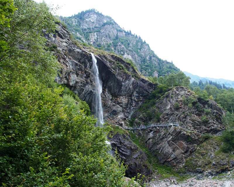
Circular itinerary that will allow you to discover a natural lake which created itself on July 27th 1642 by a big landslide of huge proportions (12 million cube meters) that detached itself from the left side of the valley (Cima di Pozzuoli). The mass of rock covered the whole valley for over 2 km, up to the gates of the village of Antronapiana. The route has a stretch equipped with suspended walkways that allows the passage behind the wonderful waterfall of rio Sajont.
The route: From the square of the church of Antronapiana take the road in direction of the Lake of Antrona and just beyond the ice rink take the trail indicated as C00 (Strada Antronesca) that reaches Alpe Cimallegra to then cross again the road. Right after you take again the trail in direction of Acqua Bona that crosses the large accumulation of landslide colonized by a dense forest. At the stream, on a patch of grass and moss, is a comfortable wooden seat that invites you to lie down to listen to the sounds of nature. The trail goes on up to the road that leads to Antrona Lago; then along the lake, it goes up passing behind the waterfall of rio Sajont and down to nearly arrive at the lakeside. Take the trail for Alpe Ronco leading to cross the road and follow it until you cross the route Antronesca you made on your way up and you will soon be back in Antronapiana.
Useful information:
For security reasons, avoid transiting in the area of the walkways with heavy rains or storms and during the winter.
Where to eat:
Restaurant Lago Pineta, Antronapiana, VB, (IT) tel. +39 0324.51808, info@lagopineta.com