Departure point:
Verbania Fondotoce (VB), Italy
How to get there:
By train: Verbania Fondotoce Station, Ferrovie dello Stato. Timetables: http://www.trenitalia.com/; www.ffs.ch
By car: A26 motorway to Gravellona Toce, exit for Verbania.
General Description:
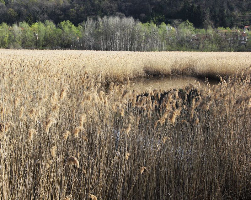
Circular itinerary of high natural interest within the Special Natural Reserve of the bed of reeds of Fondotoce, established in 1990, in the coastal reed beds of the Borromean Gulf (Golfo Borromeo) and the river Toce. Typical wetland enclave in an area of great human settlement. The management of the protected area is made by the Agency of the management of the protected areas of Ticino and Lake Maggiore. The territory of the reserve is part of the Zona di Protezione Speciale “Fondotoce”, Protection area at an European level, identified under the European Directive 2009/147/CE (Directive Uccelli).
The route:
From the station go down towards the road that you cross going at the car-park nearby, at the end of which you will find a trail to reach the cycling trail Gravellona Toce – Fondotoce. Passing under the road for Baveno – Fondotoce, you reach the road leading to the Camping Isolino. Take right for the trail going along the river Toce within a thick forest with white willows, black and white alders, poplars and elms. You will reach a small beach where you can admire the Borromean Gulf and the Islands of the Lake Maggiore (second Italian lake for its surface, 212.5 km2. Average depth of 176.5 m and maximum of 370 m).
The trail reaches the road for the Camping Isolino. Here, in periods of guided visits, you can visit the ringing station of the Center for Migration Studies where a scientific research program is conducted based on the marking of birds captured with special nets and then released into the wild.
Through the cycle tracks, along the reeds and the final stretch of the canal of Fondotoce that connects the Lake of Mergozzo with the Lake Maggiore, you finally reach one of the most striking observation point of the reed. We return along the same itinerary until you reach the station.
Useful information:
For information and specialized educational visits for schools contact:
• Ente di Gestione delle Aree Protette del Ticino e del Lago Maggiore ( Villa Picchetta - 28062 Cameri)
• Cooperativa Valgrande, specialized in proposals for Environmental Education (www.coopvalgrande.it).
• La Casa del Lago (http://www.lacasadellago.it) multimedia center, museum and laboratory, specialized in scientific and biological disclosure relating to the Lake Maggiore.
Where to eat:
La Gallina che fuma, via Turati 1 - 28900 Fondotoce VB, Tel. +39 0323 586851
Vecchia Osteria Buscaglia, piazza Adua, 28924 Verbania, Tel. +39 0323 496448