Departure point:
Piancavallo di Oggebbio (VB), Italy
How to get there:
By train: Verbania- Pallanza Station, Ferrovie dello Stato. Timetables: http://www.trenitalia.com/; www.ffs.ch
By bus: bus for Piancavallo, Line Verbania - Premeno-Piancavallo. Timetables: www.vcoinbus.it
By car: A26 motorway to Gravellona Toce, then SS34 of Lake Maggiore, reach Verbania-Intra and take the road towards Premeno. Once you passed Premeno, continue in direction of Piancavallo, you will first reach Alpe Manegra and then Piancavallo.
General Description:
Scenic itinerary on Lake Maggiore characterized by the presence of fortifications of the Cadorna Line, complex network of trenches and small bunkers that never had a war employment but represents today a wealth of hiking trails and a site of military archeology.
The route:
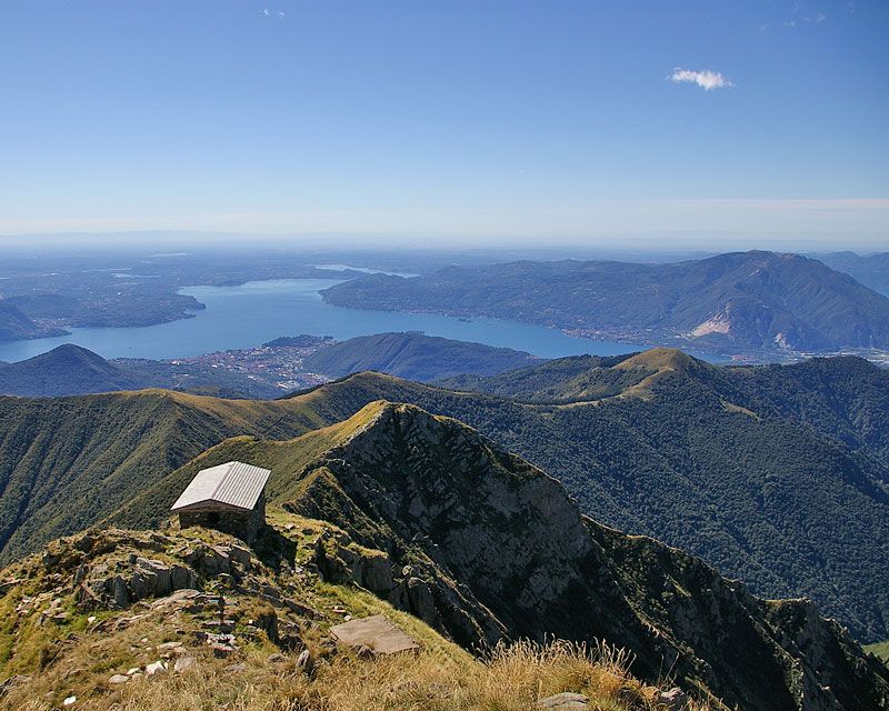
From Piancavallo follow first on a short stretch the road towards Colle. Shortly after you leave it, go up on the right until you reach the Mount Morissolino and go down then along the peak leading to Mount Morissolo. The surroundings of Mount Morissolo are characterized by the presence of fortifications of the Cadorna Line, including a dense network of military mule tracks, trenches, artillery positions and spotting places, realized in 1916 with a defensive function against a possible German attack through Switzerland. From Mount Morissolo take the track leading to Colle and from here get on the road going up to Mount Spalavera. Even at Mount Spalavera, just below the top, you can see other remains of the trenches. From the top, place of an exceptional view, you go down along the north ridge through a thick beech forest until you reach the trail going back to Colle. From Colle you walk in reverse the route up to the Mount Morissolo, from here you can follow, an alternative way that the one you took forward, by the flat military road that, with a beautiful view on Lake Maggiore, leads you back to Piancavallo.
Useful information:
In Piancavallo a service of free bike-sharing is offered. At the moment (2014) there are16 MTB and a total of 60 MTB are expected (2015)
Information: https://www.facebook.com/CadornaBikePark?ref=hl
Where to eat and stay:
La Dislocanda – Hotel Restaurant – Strada Cadorna, 26, 28824 - Manegra di Oggebbio, VB, (IT) tel. +39 0323 587173 www.dislocanda.it
La baita di Piancavallo – Bar/ Restaurant – Via Luigi Cadorna, 91 – 28824 – Piancavallo di Oggebbio, VB, (IT) tel. +39 0323 587396 www.ristorantebaitadipiancavallo.com/