Starting point
The itinerary starts from the square outside the Town Hall of Caltignaga.
How to get there
By car
Autostrada A4, exit “Novara ovest” in the direction of Novara.
Autostrada A26, exit Borgomanero in the direction of Novara
By train
Caltignaga railway station
By bus
Fontaneto Autoservizi S.p.A.
Via Volta n. 85 - 28100 Novara
Tel. +39 0321 391601
E-mail: fontaneto@msoft.it
Main features of the route
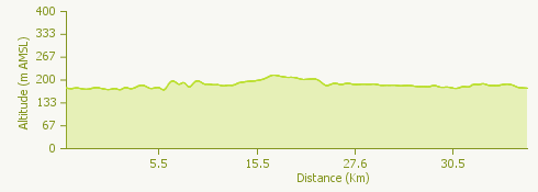
This is a round trip across the plain of the province of Novara, partly on surfaced roads and partly on trails. It is not a hilly route. You go past the rice-fields, featuring irrigation canals and ancient abbeys, which were once self-contained fortified communities, and are now complexes of farm buildings.
The route
Starting from Caltignaga Town Hall, cross the Regional Road (SR) 229 and go as far as the underpass under the railway line; take the first turning on the left to get onto the trail.
You pass the Cascina Codemonte (“Cascina” means “farmhouse”) to the right, and go on past the area where there was once a kiln, the Fornace Beldì, recognisable by its chimney stack. Continue to the village of Cavagliano, where you can see a castle and a church. Go on under the castle arch. Turn right onto the “Novara Way” trail, cross the railway line and then turn left onto a trail leading to the Cascine Bertinelle.
Next, turn right and cycle along a long scenic stretch of the trail, a very picturesque ride through the famous rice fields of the Novara Hill area, then join the surfaced road leading to the Abbey of Dulzago, a religious complex dating from the 12th century.
Go into the complex through the south gate, passing courtyards, houses, the church, the tavern, stables and storehouses, leaving through the north gate. Turn left, past the old cemetery and the oratory church, and go on to the banks of the Terdoppio stream.
To go back take the trail on the right and go on past rice fields and canals following the signs for the “Sentiero Novara” (Novara Way) until you get to the outskirts of Alzate. At Cascinini turn right towards Colombrone, where the route turns left, and joins a broad trail.
Carry on to the right to Cascina Induno, where there is the pretty Oratory church of Santa Maria, and cycle on past the rice fields for around a kilometre and a half. Cross the SR229 and you arrive in Agnellengo.
Take the Provincial Road (SP) 17 to get to the farms of Bischiavino and Solarolo. At this point you are not far from the moraine promontory of the River Valsesia, at the foot of which you can see a fortress and the church of Proh. There are two country restaurants here where you can sample some excellent paniscia, a speciality of the Novara area: risotto with sausages and vegetables.
The trail goes on to the medieval bridge over the Mora canal. Go along the side of the canal for some kilometres until you come to a surfaced road. Turn left onto the SP 101 and proceed northwards, going through the village of San Bernardino and past the oratory church of Sant’Antonio Abate.
Shortly after you will arrive in Morghengo; cross the bridge over the Agogna, and when you get to the fork for Sologno, turn right to go back into Caltignaga.
Useful information
Buses run from Novara to Catlignaga:
Fontaneto Autoservizi S.p.A.
Via Volta n. 85 - 28100 Novara
Tel. +39 0321 391601
E-mail: fontaneto@msoft.it
Refreshment facilities
There are many bars and restaurants in Caltignaga, Alzate, Momo and Proh.