Starting point
Cappella Porta, Caprezzo (974 m a.s.l.)
How to get there
By car
Autostrada A26 to Gravellona Toce, then take the road to Verbania. From Verbania take the road via Cambiasca to Caprezzo.
By train
The nearest railway station is Verbania
By bus
See the VCO in bus website
Short description of the route
The itinerary follows the nature trail of the Val Grande National Park, the largest wilderness area in Europe.
In the heart of the Upper Lake Maggiore area, the route goes through luxuriant woodlands, with superb views of the Val Grande mountains, the hillside of Val Pogallo and Lake Maggiore. There is also a mountain hostel on the route.
The route
You can get to the little chapel of Cappella Porta by car from Verbania, via Cambiasca and Caprezzo. The car park close to the chapel is the starting point for the Val Grande National Park nature trail designated “In the shade of the firs”, which it is worth walking right to the end.
You begin on a clearly visible track that leads through a beech wood to the fork for Pian Trusello, where the path starts for another chapel, Cappella Fina. You go up a ridge to Alpe Cornala and then leave the track to the left, continuing on more or less level ground through fir woods to the Bui spring.
You now join the path from Intragna, which takes you in a short time to the hostel. From the hostel it’s not far to the chapel on the ridge leading to Monte Todano, where there is a fine view.
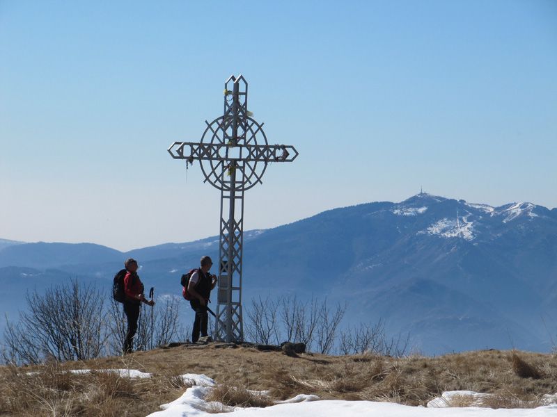
Go up the ridge to the top of Monte Todano, from where the view is really spectacular. Go back to the chapel and continue as far as the Piancavallone cross, after which you come to a shelter and the remains of a hotel, behind a row of plane trees.
Go on until you come to the fork for Pizzo Pernice, on a highly panoramic path with views on both sides, of the lake and the mountains. The path now descends through larches, firs and beeches to Cappella Fina; before this you pass yet another small chapel at a viewpoint, which can also offer some shelter. The path now goes through a birch wood.
To get back to Cappella Porta take the forest track, initially suitable for 4x4s and then becoming a footpath, as far as the fork for Pian Trusello, from where you return the way you came to go down to your starting point.
Useful information
Bus: VCO in bus
Refreshment facilties: Rifugio Pian Cavallone, tel. +39 0323 556679